Last updated: 2026-07-07 · Current scope: full Great Britain road-link risk outputs.
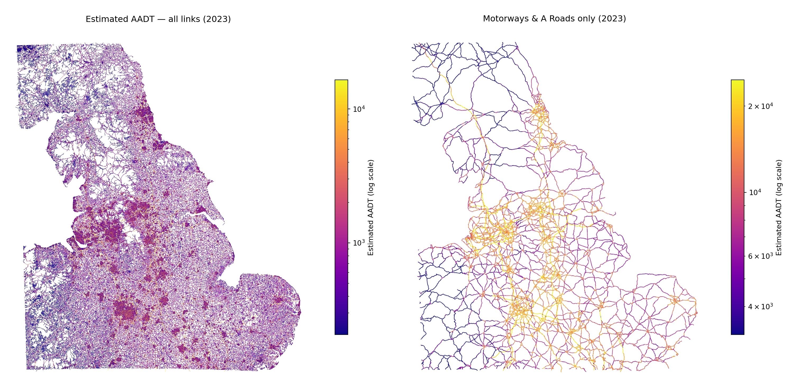
Traffic
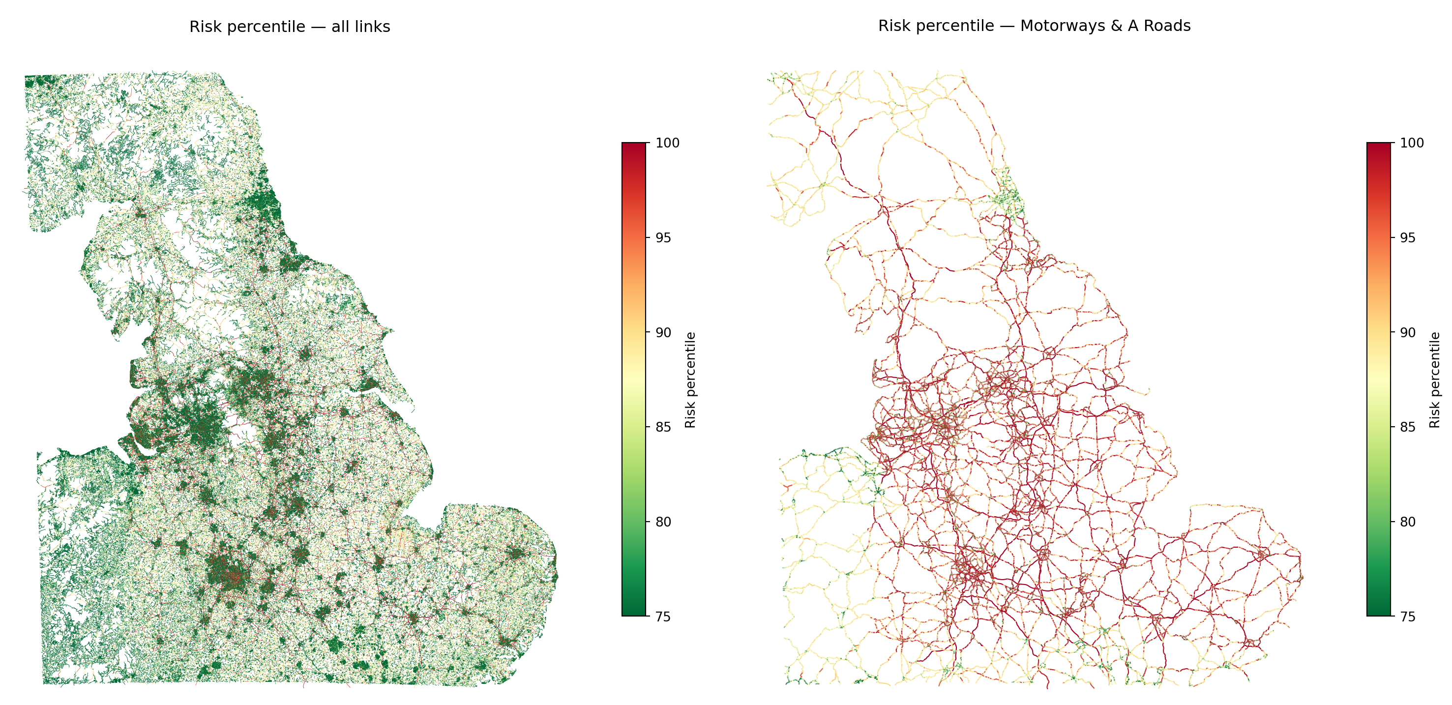
Collision risk
What this project is
Open Road Risk is an open-source pipeline for estimating an exposure-adjusted collision risk model across the road network.
The core idea is simple:
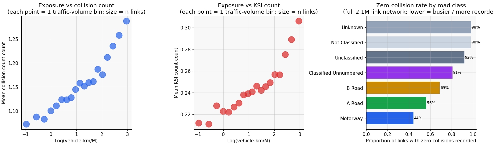
raw collision counts are misleading without traffic context.
A road with ten reported collisions may be unusually dangerous if it carries very little traffic, or relatively safe if it carries very high traffic volumes. To compare roads fairly, collisions need to be interpreted relative to exposure.
This project combines open road network, traffic, and collision datasets to estimate risk at road-link level and support network screening, corridor comparison, and safety analysis.
The QGIS-ready full-GB link-level GeoPackage export is available as a public Kaggle Dataset. It contains one row per OS Open Roads link with geometry, estimated exposure, observed injury-collision summaries, and modelled risk ranking fields.
Open Road Risk is an independent personal research and software project. It uses public/open datasets and is not produced by, endorsed by, or representative of DfT, National Highways, DVSA, Ordnance Survey, Office for National Statistics, or any other public body.
Why this matters
Most roads do not have direct traffic measurements.
Official traffic counts are concentrated on major roads and sampled count points, while collision records exist across the network. That creates a common problem in road safety analysis:
- collisions are observed widely
- exposure is only partially observed
- direct comparison is therefore difficult
This pipeline addresses that by estimating traffic where it is not measured and then modelling collision risk in relation to that estimated exposure.
Site guide
The site is organised around the logic of the pipeline:
- Project Overview — overview of repository layout, modelling stages, and current status
- Data Sources — what each dataset contains and what it can and cannot tell us
- Methodology — how sources are joined and transformed into modelling inputs
- Analysis — model behaviour, outputs, and exploratory evaluation
- Future Work — research questions and extensions the pipeline can support
A good place to start is with the source pages for STATS19 collision data, AADF traffic counts, and WebTRIS sensor data, then move to the methodology pages on joining road safety datasets and feature engineering.
For possible extensions, Future Work collects research questions that are not in the active backlog but are natural next uses of the same road-link, exposure, and collision-risk infrastructure.